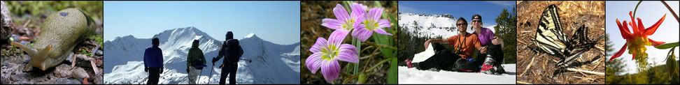
Friday, September 09, 2005
Royal & Deception Basins (8/29-9/03/05)
 Bear, glaciers, deer, steep peaks, marmots, sunsets, and a nasty bushwack. Yes, a fantastic trip!
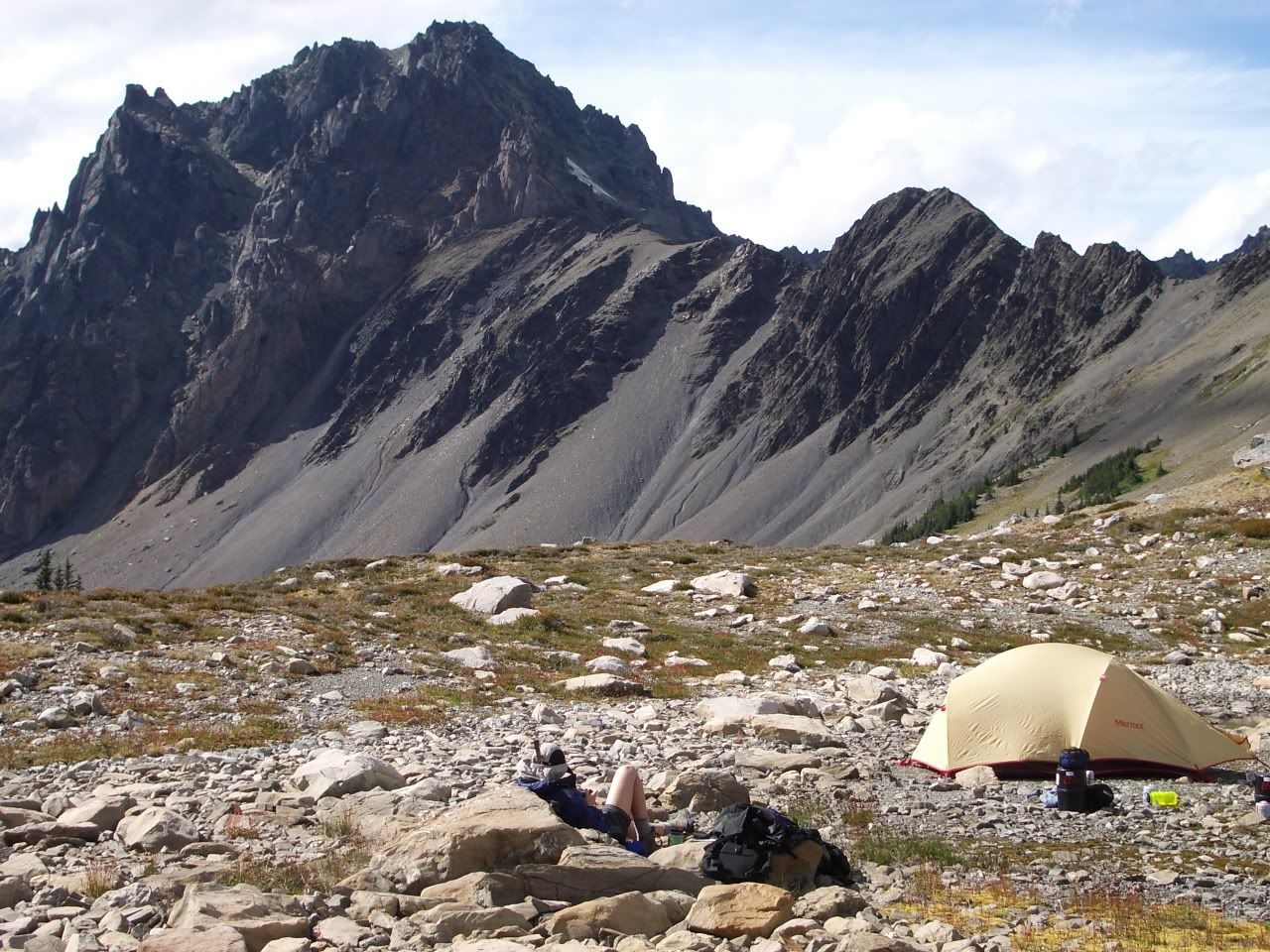
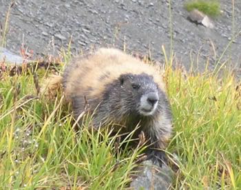
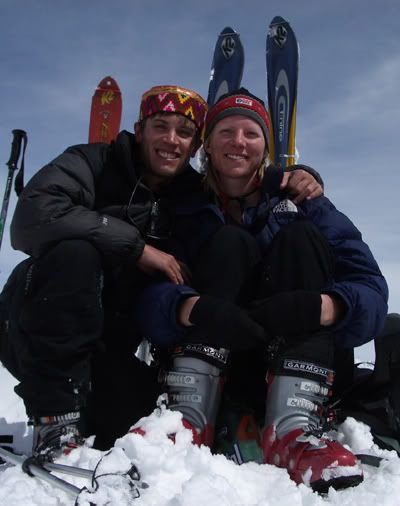
Leaving the trail late Monday, we lucked out missing the rain, and arrived via headlamp to a campsite next to Royal Lake. The next day we wandered higher into the basin, impressed with the amount of deer and marmot around. We setup camp next to the bigger tarn towards the west side of the basin below Mt. Deception. Mr. Royal Basin himself, Rob Palmer, joined us that evening. He brought two surprises for us, his buddy John, and a bottle of Jamaican rum...both which turned out to be quite entertaining. Thanks Rob.
That afternoon Rob and I went up to the ridge between Royal & Deception Basins so I would have a better idea of the start of our cross-country route. It was truly awesome to see how stoked Rob was to be back in this area as he continually was gazing up around him with
 a permagrin on his face.
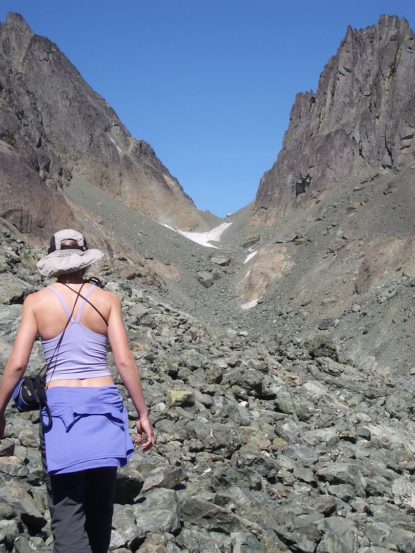
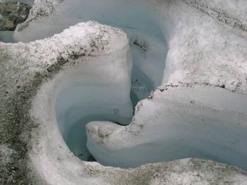
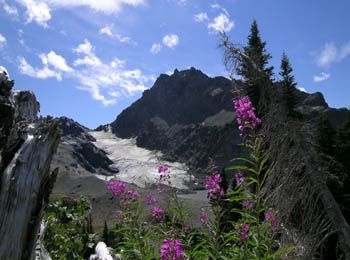
The next morning, Rob & John headed down, and Emily and I headed out on a fantastic day trip up to Surprise Pass over a small receding glacier. The glacier had a thick layer of sediment on top and crazy longitudinal crevasses that were created from water erosion. It was a great laboratory to see up close the insides of these geological machines. Through lateral moraines, there is evidence th
 roughout the basin of where glaciers used to reach to. Instead of seeing Olympus as expected from Surprise Pass, we saw the lower rolling hills that constitue the north end of the park. With the sun shining directly on us through the Needles and Mt. Clark, a flat rock provided a most cozy nap location which was more rewarding than the vistas.
We returned to camp, chilled out, and hoped the weather would remain good. The n
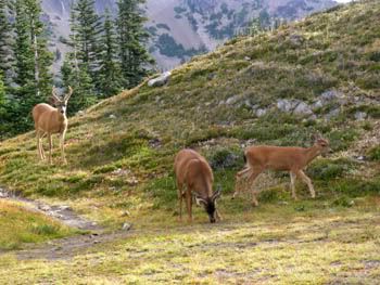 ext morning we not only had clear skies, but a lovely visit from 8 young deer as we ate breakfast.
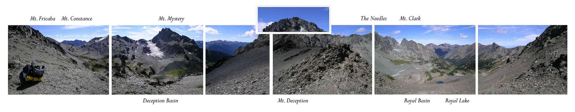
We then packed up and headed south up the ridge to Deception Basin. Em was getting picture crazy as we continued to ascend, impressed more and more with the views. I truly admire her ability to get in yoga like positions to take flower pictures with her overnight pack on. I also see this as great Himalayan training! I knew she would be stoked when we topped out and looked south at Mt. Mystery (another mean peak). Check out this 360 panorama. This area is quite contrary to the generalization that the Olympics are small and rolly. Mt. Deception and Mt. Mystery are jagged and tall as Deception is the second largest peak in the park, just ~150' lower than Olympus. This area is hidden from the Seattle view by Mt. Constance.
We descended into Deception Basin and set camp up high (high enough to view Olympus)! After some chill time, we wandered the extents of the basin from the lake at the terminus of My
 stery's glacier to the outfall of the basin. Em struck gold with more tadpoles, but otherwards a mammal-lonely area. That night we viewed the sun setting between Mystery's steep north ridge and Deception's dramatic south ridge.
The next day begun great! More blue skies with some low fog rising out of the valleys. We moved east over a ridge to eventually circumnavigate Hal Foss Peak before dropping into Heather Creek. We dropped our large packs just after the ridge and scrambled north up Mt. Fricaba. This summit gave us great views of Warrior Peaks and Mt. Constance. Very relaxed, we layed down and napped on the summit. We didn't realize at the time how enjoyable this was and would be dreamed about.
Back at the packs, we traversed south along a somewhat nasty slope (steep, loose, firm,
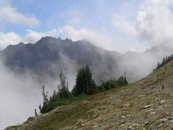 somewhat nasty). We ended up losing our elevation for safety and then asceding a ridgeline to get to our desired point to drop into Heather Creek. This whole time the marine layer was pushing east off Hood Canal, and not only filling in the valleys but consistently swirling up around the tops of the peaks. We were relieved to discover our descent into Heather Creek was fairly easy (more scree surfing!). We knew a designated trail begun towards the bottom of the valley. The problem was there was thick forest before the trail. Yes, alders filling up any lower canopy of the hemlocks and firs. Very nasty. After a break and a short tree climb to get a lookout, we knew we needed to head back away from the creek. This is when Em must have conducted a major mental prep-talk (which she did confirm later) as I had trouble keeping up with her the next 20 minutes. All in all, we still had tons of daylight and didn't have to negotiate skis through the timbered mess.
We finally found the trail and then decided to head down it until the first decent looking campsite. Well, after a couple hours and with headlamps on, we came to a clearing with tall grass where the trail seemed to spider into many directions. Rather than let things continue to get worse, and discovering there was flat space in the grass, we decided to call that area our camp. Relieved, Emily unloaded her pack and we headed to the creek for water. Next to the creek, we discovered a desig
 nated campsite with firepit, log seats, and spade. Now relieved and happy, we moved our packs to the site, quickly got the tent setup, and enjoyed a hot dinner. We had been moving for over 10 hours ascending ~2300' and descending ~5300' mainly with large packs.
We awoke slowly the next morning and saw our first person in 3 days as he yelled over to warn us there was a momma bear with a cub a little ways back. Sure enough, we saw the same two bear as we were heading down the trail later that morning. Quite a great conclusion to a backpacking trip that had it all.
Labels: hiking
![]()


